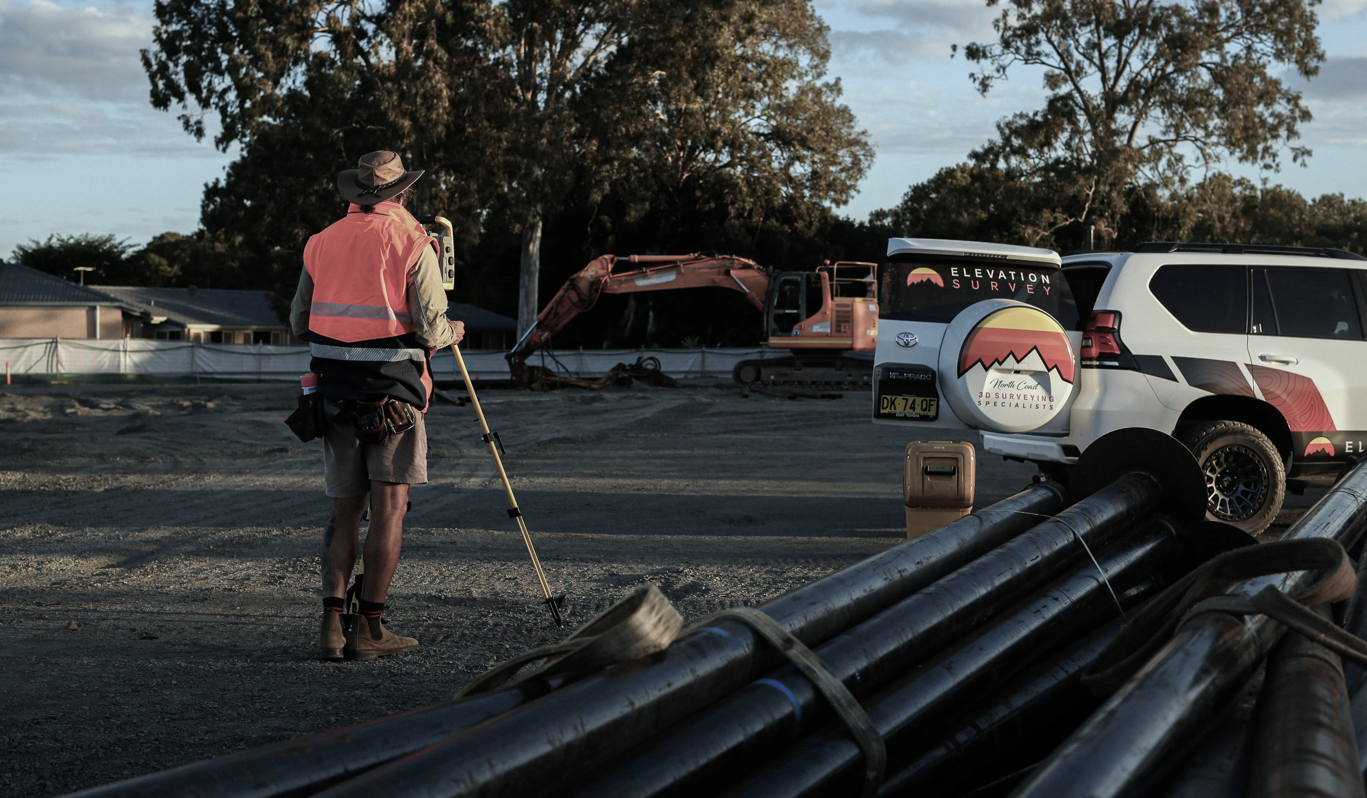
Accurate site information is the foundation of successful planning, design and construction. Whether a project involves a refurbishment, extension, fit-out or new development, the quality of survey data influences decision-making, coordination and risk management. As technology continues to evolve, property owners, architects and contractors are increasingly comparing traditional surveying methods with 3D laser scanning to determine which approach offers the most value for their project.
At Elevation Survey, understanding the strengths and limitations of each method helps clients choose a survey strategy that suits the site, design requirements and level of detail needed.
While both methods are used to capture accurate measurements, they differ in how data is collected, processed and applied. The right choice depends on the project’s complexity, required outputs, budget, access conditions and risk profile. Understanding these differences can help ensure the survey information supports efficient design development, reduces uncertainty and contributes to a smoother construction process.
Both 3D laser scanning and traditional surveying aim to capture accurate site information, but they do so in different ways. Choosing between them can affect project speed, level of detail, cost and how easily design teams can use the data.
The most practical way to compare them is to look at accuracy, level of detail, speed on site, data output and how each method supports different stages of a building project.
Traditional total station or GNSS surveying provides highly accurate coordinate data for selected points or features. This is well-suited to setting out grids, boundaries, key corners, openings and structural elements where discrete measurements are sufficient.
3D laser scanning also provides accurate data, but across a much denser field of points. Instead of capturing individual spot measurements, it records a full 3D point cloud of visible surfaces. For complex façades, plant rooms, heritage buildings or irregular existing structures, scanning can produce a much richer record of site conditions.
This level of detail can make small misalignments, deflections or clashes easier to identify. Details that may be missed between selected survey points can become visible within the point cloud or derived model.
Traditional surveying is generally slower on site for complex or heavily detailed areas because each point must be selected and measured individually. However, it can be very efficient for open sites with simple geometry, such as greenfield developments or regular building layouts.
3D laser scanners can collect millions of points in minutes. For large buildings, congested plant areas or detailed refurbishment projects, this can reduce site survey time and limit the need for repeated visits. Scanning can also be useful where access is difficult, as many features can be recorded from a distance. This may reduce the need for working at height or entering hazardous areas.
The trade-off is that laser scanning usually requires more office processing. Point clouds need to be registered, cleaned and converted into usable outputs such as 2D drawings, 3D models or BIM-ready files. Traditional surveying often has the opposite balance, with more time spent on site and less intensive data processing afterwards.
Traditional surveying commonly produces 2D CAD drawings, levels, coordinates, feature surveys and setting out information. These outputs are well-suited to title plans, basic floor plans, sections and elevation outlines where highly detailed surface information is not required. File sizes are usually manageable, and most project teams can work with the data immediately.
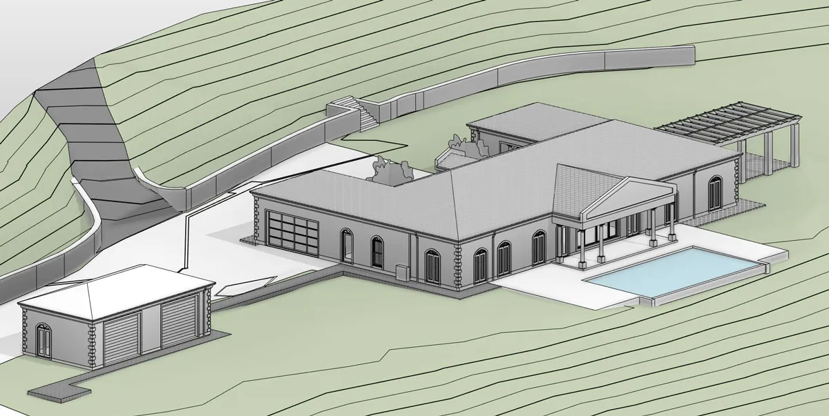
3D laser scanning provides a more detailed digital record. Designers can take sections through the point cloud, extract additional measurements later or revisit areas virtually without returning to site. This can add significant value for complex refurbishments, services coordination, clash detection, façade works and heritage projects.
For small or uncomplicated sites, the upfront cost of scanning and processing may be harder to justify. As project complexity, coordination risk or the likelihood of design change increases, the value of a richer 3D dataset can outweigh the additional cost. Traditional surveying remains cost-effective where the brief is limited, the geometry is simple and only core structural, level or boundary information is required.
Traditional surveying still has a clear place in modern construction and property projects. It is often the most suitable option where the site is relatively simple, the budget is limited or the required outputs are focused on standard plans, levels and boundary information.
Choosing traditional methods is not about settling for less technology. It is about matching the level of measurement detail to what is genuinely needed for planning, design, legal or construction purposes. Conventional instruments and techniques can provide the required accuracy in a straightforward and cost-effective way.
For modest projects that do not involve complex structures or congested sites, traditional surveying can offer excellent value. Using total stations and GNSS equipment, a surveyor can efficiently capture the key features and levels needed for design.
Traditional surveying is often well-suited to:
On these projects, architects and engineers often need clear plans with building outlines, boundaries, key levels and visible features rather than dense 3D data. The additional information produced by laser scanning may add cost without providing a meaningful benefit to the design process.
Where the main concern is legal definition of land or compliance with planning and regulatory requirements, traditional surveying is often the more appropriate method. These tasks depend on established techniques recognised by land registries, authorities and professional standards.
Typical examples include boundary reinstatement, title surveys, check surveys and subdivision plans. The objective is to establish the position of boundary lines, fences, walls and markers relative to control points using proven methods and traceable measurements.
For topographic surveys that support planning applications, many authorities and project teams still expect familiar outputs, such as 2D plans with spot levels, contour lines and feature codes. Traditional surveying is well suited to producing these deliverables efficiently and with the precision required to support design, drainage and planning decisions.
Traditional surveying can also be the right choice when budget or site conditions make laser scanning unnecessary or impractical. The equipment, processing and modelling costs associated with scanning may be difficult to justify for smaller or price-sensitive projects.
On tight urban sites, vegetated areas or locations with restricted access, a surveyor using conventional instruments can often apply selective setups and professional judgement to capture the data that matters most. This focused approach can reduce field time and keep data volumes manageable while still delivering reliable coordinates and levels.
Traditional methods are also advantageous where line of sight is easy to maintain and a clear survey control network can be established. In these situations, total station work can often meet design tolerances without the additional processing associated with scan registration and point cloud management.
3D laser scanning is not necessary for every project. It becomes valuable when a project requires a dense, detailed record of existing conditions or when coordination risks are difficult to manage with selected survey points alone.
The decision usually comes down to project complexity, risk and how heavily the design or construction process depends on accurate existing-condition data. Scanning is most useful when there is a need to reduce unknowns, avoid clashes before construction and create a digital record that can be revisited throughout the project.
Laser scanning is useful on refurbishment, extension and fit-out projects where existing structures are irregular, congested or poorly documented. Historic buildings, older industrial sites and properties that have been altered multiple times can benefit from the high-density point cloud that scanning provides.
In tight or complex spaces, traditional measurements can miss obstructions or hidden relationships between elements. A 3D scan can capture the geometry of steelwork, ductwork, pipework, cable trays and surrounding surfaces in one coordinated dataset. Designers can then use this information for MEP coordination, structural alterations or accurate as-built modelling.
Scanning is also worth considering where access is limited or disruption needs to be reduced. Occupied offices, hospitals and live manufacturing environments, for example, may be surveyed with less downtime and fewer repeated site visits.
Where small dimensional errors could lead to costly problems, laser scanning can provide an extra level of assurance. This is especially relevant for:
Point clouds and derived models give designers a detailed reference for clash detection and tolerance checks. This supports coordinated BIM workflows across architecture, structure and building services. On larger or more complex projects, the reduction in rework, uncertainty and site adjustments can help offset the higher upfront survey cost.
On some projects, a detailed visual and archival record is just as important as raw dimensions. Laser scanning can produce coloured point clouds and panoramic imagery that can be navigated virtually, which is useful for stakeholders who cannot regularly visit the site.
This can be valuable for heritage assets, complex facilities and long-term asset management strategies. A single comprehensive scan can support future refurbishment, space planning, maintenance and documentation without repeated mobilisation of survey teams.
Scanning is also worth considering where planning approvals, public consultation or stakeholder sign-off depend on clear visualisations. Accurate 3D context can support realistic renderings and verified views, helping demonstrate the impact of proposed works more clearly than line drawings alone.
Both 3D laser scanning and traditional surveying can be used together on a single building project. In many cases, this blended approach is the most efficient and accurate option. The key is to allocate each method to the tasks it handles best, then integrate the results into a single coordinated dataset.
Combining methods can be valuable on complex refurbishments, constrained urban sites or projects where legal boundaries, survey control and detailed existing conditions are all important.
A typical mixed-method workflow uses traditional surveying for control and legal definition, then 3D laser scanning for detailed building information.
A practical sequence often looks like this:
This approach helps ensure legal and planning requirements are satisfied while designers receive a detailed and measurable 3D dataset for modelling and coordination.
Using both methods together is most beneficial in situations such as:
Traditional surveying provides the control network and statutory clarity, while 3D laser scanning delivers the data density needed for BIM models, clash detection and detailed coordination.
A mixed approach must be planned carefully to be effective. Clear decisions are needed on which elements will be measured traditionally, which areas will be scanned and how the datasets will be shared with the design team.
Important technical points include:
When properly coordinated, the combined method can reduce site visits, minimise rework and provide a richer information base than either technique alone, while still helping control cost and programme.
A clear conversation before any survey starts is essential when choosing between 3D laser scanning and traditional surveying. The right questions can clarify scope, accuracy, deliverables and timescales so the chosen method supports planning, design and construction without delays.
Pre-survey discussions should focus on what the data will be used for, how it will be delivered and how it fits with the wider project team. The aim is to leave no doubt about what will be captured, to what standard and by when.
The first point to clarify is what decisions the survey must support. Planning applications, detailed design, heritage refurbishment and structural alteration each require different levels of precision and detail.
Ask the surveyor to explain what level of accuracy will be achieved and how that translates into practical tolerances. For example, a designer coordinating services in a plant room may need a high level of measured detail and tight tolerances, which can make 3D laser scanning more suitable than relying on selected survey points alone. A boundary check for a garden wall, however, may be adequately served by traditional total station work.
It is important to agree on which elements are critical and which can be captured at a lower level of detail to control cost.
The extent of survey coverage should be clearly defined before work begins. Discuss which areas are in scope, such as internal spaces, roof structures, external elevations, surrounding streets or neighbouring buildings, and which areas are excluded.
Confirm access arrangements for occupied buildings, secure sites or constrained city locations, as these can affect the choice between rapid scanning and more targeted traditional techniques.
Site conditions such as low light, reflective surfaces, heavy vegetation or public access can also influence the method and programme. Ask how the surveyor will manage safety requirements, out-of-hours work or the need to keep commercial operations running. Where scanning may capture neighbouring properties or public areas, it is also worth discussing privacy and data management.
Before work starts, the surveyor should set out exactly what will be delivered, in what format and on what timeline. This may include point clouds, 2D plans, sections, elevations, 3D models or a combination of outputs. It should also include required software formats, such as DWG, RVT or IFC.
Clarify the intended level of detail for any BIM or 3D model. For example, confirm whether small fixtures, pipework and services are to be modelled or only the primary structure and building fabric. Discuss coordinate systems, datum levels and how the survey will tie into existing project information so designers can integrate the results without rework.
Finally, confirm turnaround times, staged deliverables and any additional charges for variations, revisits or extra modelling so the survey method and programme align with the rest of the project.
The choice between 3D laser scanning and traditional surveying depends on the specific demands of the project rather than a one-size-fits-all preference. Traditional surveying continues to provide a reliable and cost-effective solution for straightforward sites, boundary work and projects where targeted measurements are sufficient.
By contrast, 3D laser scanning offers a detailed digital representation of existing conditions that can improve coordination, reduce uncertainty and support BIM-driven workflows on more complex developments. In many cases, the best outcome comes from using both methods together, with traditional surveying providing control and legal clarity while scanning captures the detail needed for design and construction coordination.
A well-planned survey strategy provides the clarity and confidence needed to support successful outcomes from concept through to construction and beyond.
.webp)

