At Elevation Survey, we’re proud to be one of the leading local land surveyors in Ballina and the Northern Rivers.
Request A QuoteOur team offers a full range of surveying services tailored to both urban and rural projects. So, whether you're planning a home build, a rural subdivision, or a large-scale development, we are the right people to call.
With extensive experience across the Far North Coast, we bring professional service, local insight, and cutting-edge tools to every job.
From concept to completion, we work closely with clients to ensure their land, planning, and property needs are covered with accuracy, care, and efficiency. Contact us to find out more!
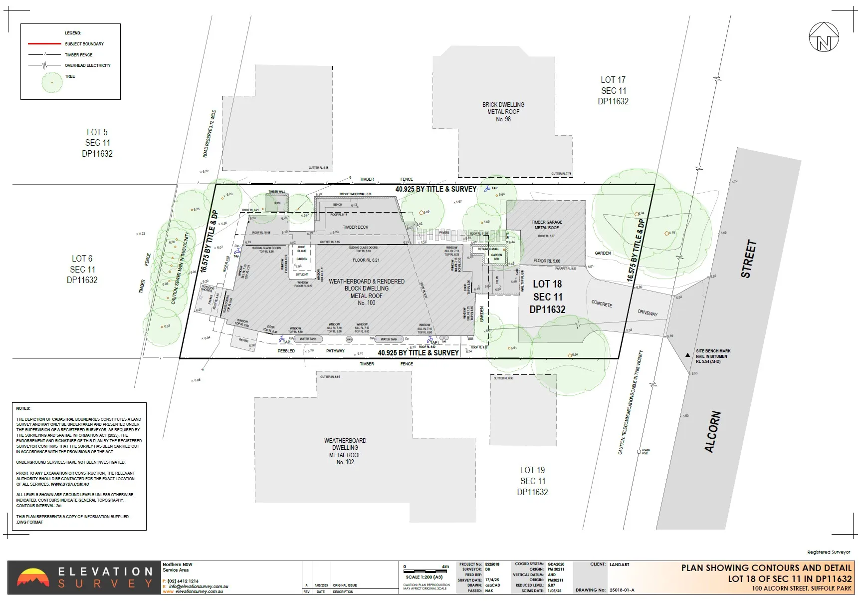
We offer a wide range of surveying services, including boundary surveys, to meet the needs of residential, commercial, and rural clients across Ballina and Northern NSW. Combining advanced technology and local knowledge, our team ensures every project is professionally delivered with precision.
If you are planning new builds, extensions, or subdivisions, we provide accurate contour land measurements that show natural and built features.
For those planning on buying, selling, or building on a property, identification surveys confirm plot boundaries and any improvements that are required.
Our experts can determine height levels relative to the Australian Height Datum (AHD), which is often required for flood assessments and council approvals.
Using drone technology, we capture high-resolution aerial images for mapping large areas quickly and efficiently.
Ideal for complex structures and jobs, our 3D laser scans create detailed digital models for design and construction.
We support commercial projects with reliable surveying, planning advice, and project management input.
Through advanced 3D laser scanning technology, we deliver highly accurate, detailed survey data for a wide range of residential, business, and development projects. Here’s how our process works from start to finish.
We begin by discussing your goals, budget, and timeline to help us tailor our surveying services to your specific project needs.
Our team then reviews existing site information, property boundaries, and relevant council requirements.
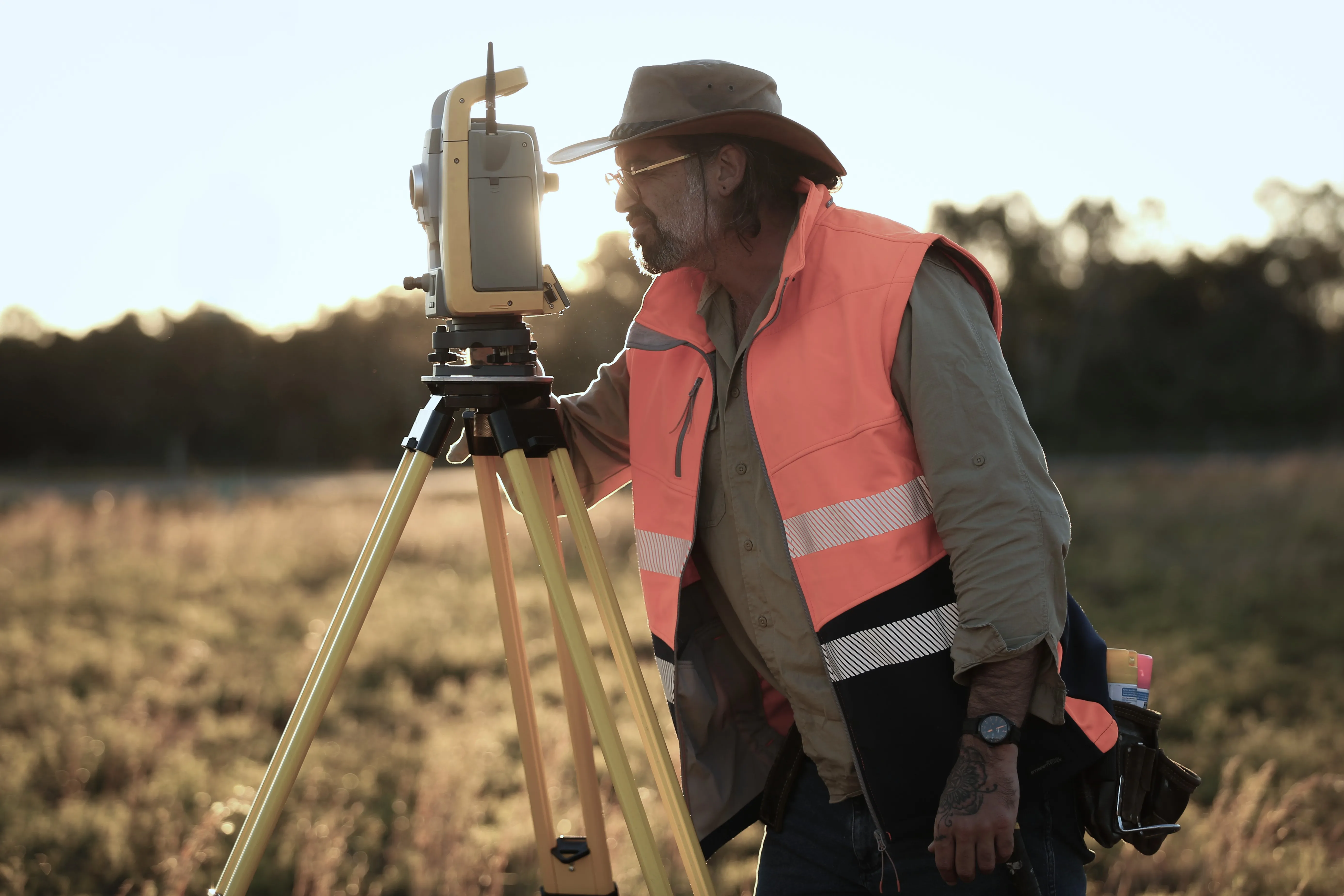
Next, using state-of-the-art laser scan equipment, we capture detailed site data with millimetre precision.
The data collected is then converted into 3D models or Building Information Modelling (BIM) outputs for use in planning or design.
We thoroughly check every survey to ensure it is accurate and review it against planning or development guidelines.
We provide you with a detailed survey report and offer follow-up support as required.
Choosing the right surveyor can make all the difference to your project. At Elevation Survey, we combine local knowledge with the latest technology to deliver results you can rely on.


You’ll need a survey when buying, selling, building, or developing property, especially for urban and rural subdivisions or council approvals.
The costs will vary depending on the property size, location, and complexity of the survey. It is best to contact us to receive a customised quote for surveying your home or business.
We provide a wide range of services, including contour surveys, identification surveys, laser scanning, and urban and rural subdivisions.
Most surveying jobs are completed within a few days, depending on the size and scope of the project.
Yes, all our surveyors are fully licenced, insured, and have several years of industry experience.
Ready to move forward with your project? Contact our team today to get a quote fast! Whether you're a homeowner building your dream home, a developer elevating a community, or a government agency, our experienced surveyors are here to assist you with all your surveying needs.
.webp)

