Accuracy sits at the heart of every successful building project. From early feasibility studies to final as-built verification, even small measurement errors can lead to design changes, site delays and coordination issues. 3D laser scanning has become one of the most widely discussed tools for capturing existing conditions, yet many project teams still want to know how reliable the data really is and whether it can be trusted for critical design and construction decisions. Elevation Survey understands that architects, engineers, contractors and asset owners need clear information, not broad claims, when assessing any surveying technology.
In this article, Elevation Survey explains how accurate 3D laser scanning is in real project environments and what that accuracy means in practical terms. You will learn how scanners capture dense existing-condition data, the typical tolerances that can be achieved for different building types and the factors that influence precision on site. The article also explains how accuracy affects BIM models, measured surveys, clash detection and as-built verification so project teams can judge when 3D laser scanning is appropriate and how to specify outputs that match the needs of the project.
3D laser scanning offers a high level of accuracy that is generally far better than traditional tape or handheld measurement methods. For many building projects, surveyors can deliver highly reliable point clouds and measured outputs that are suitable for design coordination, clash detection and high-quality as-built records.
However, the practical accuracy clients receive depends on how the scan is specified, captured, registered and processed. Factors such as the size of the building, scanning range, instrument capability, control network, registration method and the required deliverables all affect the final tolerance. Understanding these variables helps project teams set realistic expectations and specify the right level of detail and accuracy for the job.
Modern terrestrial laser scanners used on building sites are commonly rated to low-millimetre precision at short range. In practice, surveyors typically work to:
These values generally describe the accuracy of the point cloud relative to itself and to the site control established by surveyors. When the scan is tied to a known coordinate system, such as a project grid, MGA control or an engineer’s control network, the absolute positional accuracy is usually governed by the quality of that control rather than the scanner alone.
Several practical factors influence how close the delivered data gets to the ideal instrument specification. The most significant are:
Elevation Survey assesses these factors at the briefing stage so the project specification matches the real needs of the design team and contractor.
The accuracy of the raw point cloud is only one part of the picture. Designers and contractors usually work from 2D drawings or BIM models derived from that cloud. The modelling process introduces its own tolerance depending on how elements are interpreted, simplified or idealised.
For example, a structural frame that varies by several millimetres along its length may be represented in the model as a straight member aligned to best fit through the scan data. In this case, the model is accurate to the agreed tolerance for design coordination, but it is not a perfect replica of every minor on-site irregularity.
Surveyors should agree on survey accuracy and modelling tolerance at the outset. For many building projects, a practical real-world outcome within normal design and construction tolerances is realistic for critical structural and architectural elements, provided the scope, control, scan geometry and modelling requirements are properly defined from the beginning.
On a live site, 3D laser scanners do not work in isolation. Their accuracy depends on how they are set up, used and managed in real-world conditions. Two projects using identical equipment can produce very different results if site factors are not properly controlled.
Professionals focus on managing these variables so that what is captured in the point cloud reliably matches the building on the ground. Understanding the main influences helps clients know what to expect and why some sites demand more planning than others.
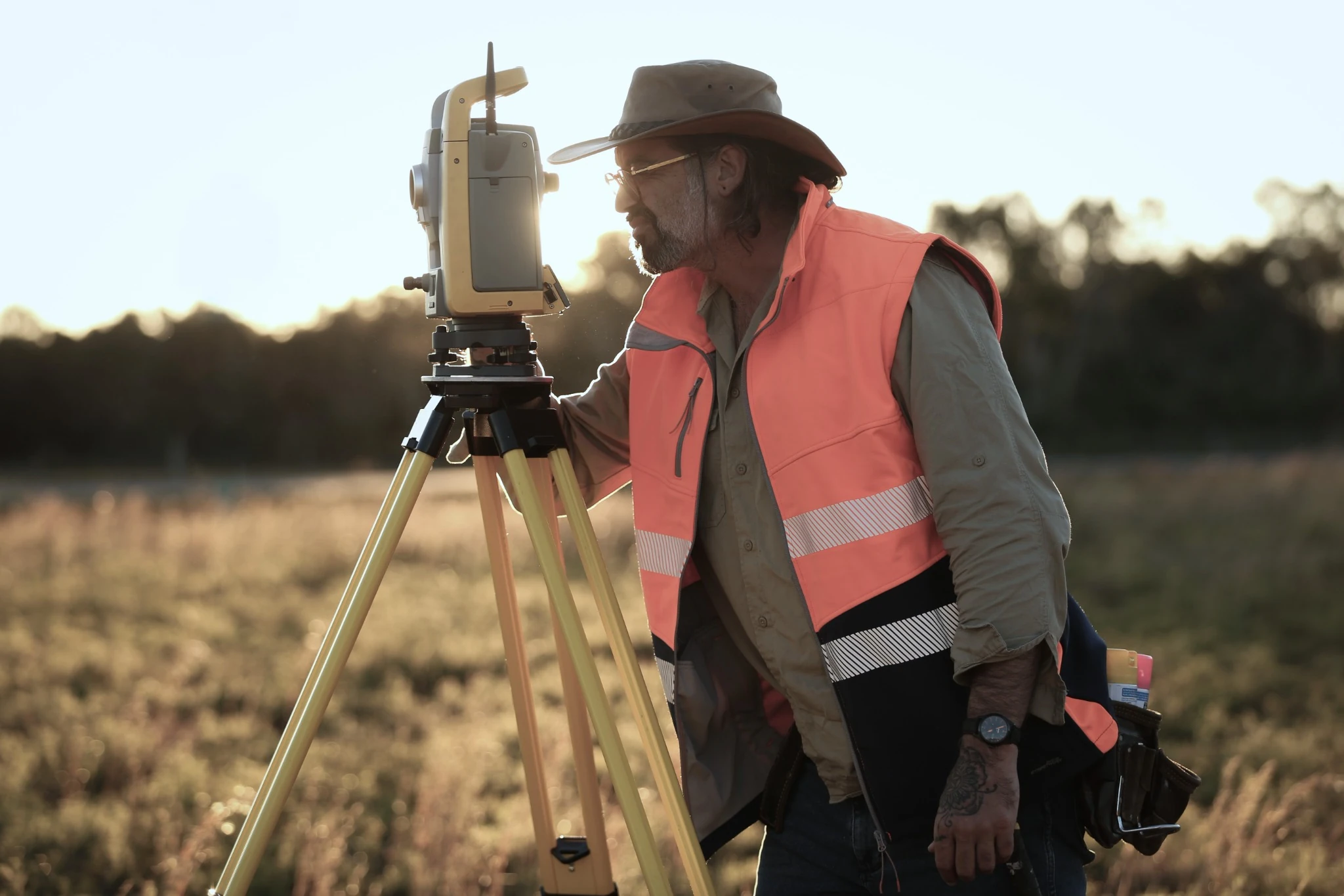
The starting point is the scanner itself. Different instruments have different stated accuracy tolerances and ranges. A high-spec terrestrial laser scanner typically records positions to a few millimetres at short range, but that performance reduces as distance increases. For example, a wall scanned at 5 m will usually be recorded more precisely than one at 40 m.
Tripod setup is equally important. If the tripod is not level or is knocked during a scan, the data can shift or blur. Experts stabilise tripods, check the bubble for level and avoid setting up on soft ground where legs might settle. The choice of scan resolution and quality settings also matters. Higher resolution captures more points and finer detail but takes longer and increases file size.
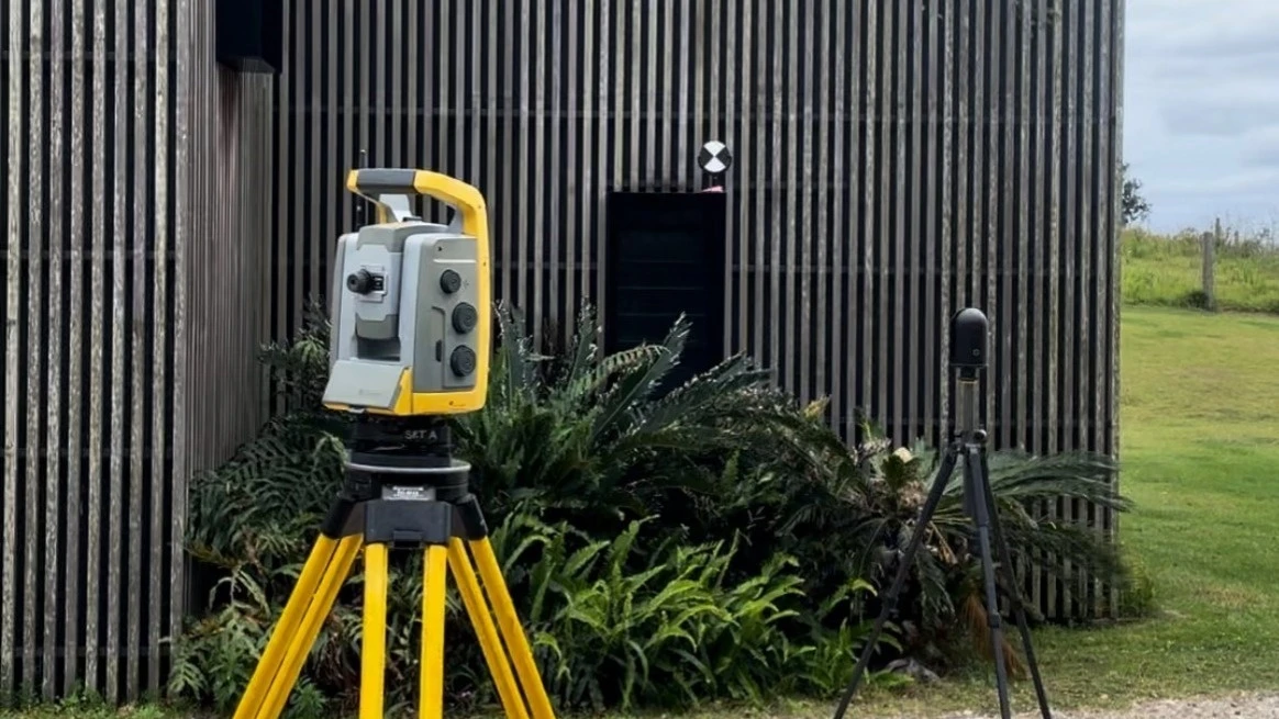
Laser scanners need a clear sightline. Anything that obstructs the beam reduces accuracy or creates gaps. On building projects, this often means dealing with parked vehicles, stored materials, scaffold lifts or vegetation. If a column is hidden behind stored pallets for every scan position, it will not appear accurately in the point cloud.
For this reason, scan positions are planned to minimise blind spots and overlap coverage. Multiple setups from different angles allow hidden corners to be filled in and surfaces to be cross-checked. Reflective or highly absorbent surfaces can scatter or weaken the laser signal, introducing noise. Professional surveyors mitigate this by adjusting instrument settings, choosing more favourable angles or scanning at different times of day to avoid direct glare.
Lighting itself does not normally affect the laser, but it affects the ability to capture high-quality site photos, which are often combined with scans. Poor visibility from dust, rain or fog can, however, degrade the return signal, so site and weather conditions are always considered when programming works.
Accurate survey control is critical. Scans must be tied to a reliable coordinate system so that each setup aligns correctly to the next and to the wider site grid. Elevation Survey uses total stations or GNSS to establish control points and then uses these to anchor the scans. Poor or sparse control tends to show up as small misalignments between rooms, floors or elevations.
The process of registration, which is the joining together of multiple scans, has a major impact on accuracy. Using inadequate overlap between setups or relying only on cloud-to-cloud alignment without strong targets can introduce small shifts. Our surveyors plan sufficient overlap, use survey-grade targets where appropriate and validate results with check measurements.
Human factors such as rushed fieldwork, incomplete site access or inadequate site notes can also reduce reliability. Clear access arrangements, a logical scanning sequence and quality checks both on site and in the office are essential to deliver the level of accuracy clients expect.
3D laser scanning and traditional surveying both aim to measure buildings accurately, but they do so in very different ways. For most building projects, the key questions are how precise the data will be, how long it will take to collect and how useful that information will be for design coordination and construction.
Professionals use both approaches where appropriate, but 3D laser scanning usually delivers more complete data in a shorter time with fewer site visits and fewer surprises once work starts on site.
Traditional surveying relies on total stations, levels and tape measures to record selected points such as corners, floor levels and key structural elements. The surveyor decides which features to measure, so the final drawing is a simplified representation of the building. Accuracy at each measured point can be very good, often within a few millimetres, but anything not measured must be inferred.
3D laser scanning records dense surface data to create a detailed point cloud of the entire scene. Instead of just corners and edges, the scanner captures full surfaces such as walls, soffits, beams and services. On building projects, scan data can commonly achieve low-millimetre accuracy at practical working ranges. The key advantage is not simply that individual points may be accurate, but that the survey captures a far more complete picture of the building. This reduces the risk of hidden deviations, such as a wall that is slightly curved or a slab that is out of level between selected measured points.
For complex buildings or busy sites, coverage is where 3D laser scanning usually outperforms traditional surveying. A conventional measured building survey might require multiple visits, access to each room and time spent manually recording dimensions. Interruptions to occupants or ongoing operations can be significant.
Laser scanning can often capture a whole floor or façade in a fraction of the time. The scanner is set up in several positions and captures each scene in a matter of minutes. Because so much information is gathered in one visit, the need for return trips is reduced. This is particularly valuable for occupied buildings, live commercial sites or restricted areas where access windows are short.
Traditional methods may still be suitable for simple plots, greenfield sites or small extensions where only key boundaries and levels are required. In those situations, the extra density of scanning data may not be cost-effective.
Traditional survey outputs are usually 2D drawings in DWG or PDF format. These are adequate for straightforward projects, but they can be limiting when architects, structural engineers and MEP designers all need to coordinate in 3D. Any clash checking or model creation must be based on the interpretation of relatively sparse measurements.
3D laser scanning supports modern digital workflows. From a single point cloud, a surveyor can produce:
Design teams can reference the point cloud directly to verify clearances, check as-built conditions and detect clashes before construction. Contractors benefit from more reliable setting-out information and fewer discrepancies between drawings and reality, which can reduce rework, change orders and delays.
For most building projects, 3D laser scanning is accurate enough for renovation, extension and new build design and coordination. Modern scanners can achieve very high levels of precision at practical working ranges, which is more than sufficient for many architectural, structural and services applications.
The key question is whether the required scan accuracy fits within the tolerances that architects, engineers and contractors need for the specific project. In practice, it often does, provided the scan is correctly specified, properly controlled and processed by experienced surveyors.
Renovations rely heavily on knowing exactly what is already there, especially in older or altered properties where drawings are missing or unreliable. 3D laser scanning typically delivers:
This level of detail allows architects to set out new partitions, align new finishes and coordinate services with the existing structure with confidence. It is accurate enough to:
Because the scan captures millions of points rather than a few tape measurements, it also significantly reduces the risk of hidden surprises on site, which is often where renovation costs escalate.
For extensions and structural changes, the connection between old and new is critical. A good-quality 3D laser scan provides:
This accuracy is sufficient for engineers to design steelwork and structural alterations to within normal fabrication and installation tolerances. It also supports:
The scan data can be imported directly into BIM or CAD, which improves accuracy through the whole design chain rather than relying on redrawn measurements.
For completely new builds on a clear site, the main use of laser scanning is often verification rather than initial design. Elevation Survey can scan:
This level of accuracy is generally adequate for platform levels, earthworks volumes and building set-out checks. For high-precision projects such as prefabricated components or façade panels, tighter scan planning and stronger control networks can support more demanding tolerances where required.
The real question is not whether 3D laser scanning can achieve a high level of accuracy for building projects, but whether the required survey accuracy has been clearly defined for the job at hand. Across planning, design, construction, refurbishment and facility management, high-quality scanning can deliver millimetre-level precision, strong repeatability and a reliable digital record of existing conditions. Its value is not just in the raw data, but in what that accuracy helps prevent: design clashes, site rework, programme delays, cost overruns and disputes. When properly specified, controlled and processed, 3D laser scanning is one of the most dependable ways to capture existing conditions for modern building projects.
.webp)

